Vanguard Costa Rica: Five Highest Peaks
Other than United Airlines, where else can one travel in Costa Rica to get some altitude? There are a lot of places to visit, but these are the top five quite literally. If you summit all five of these peaks you can brag about it at every social event you attend. Chances are good you won't have much competition at said party, unless Warner Rojas is pouring the punch. (He was the first Tico to climb Everest.)
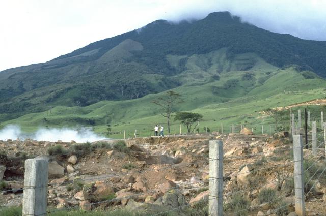
Miravalles Volcano
Elevation: 6,654 ft
Map Points: 10.748153, -85.153059
The fifth highest peak of the bunch is the highest point in the Guanacaste mountains. It's no ordinary mountain though. Once it spewed, to quote Wikipedia "dacitic-rhyolitic pyroclastic flows.” Of course that was a million years ago… literally.
These days Miravalles is just another awesome tour of strange lands for tourists. Tours drive up the side of the mountain and get would be climbers close to the steam vents which currently power geothermal harvesting plants. You can also take a horseback tour, or if you’re really bold, a nine-hour hike. Don’t go looking for trails though. This is protected land by the government, but there are no well-defined trails.
Getting there is a short drive from either airports, and there is a bus line which swings by. You take the bus to Bagaces and tell the driver you are headed to “Volcan Miravalles.” It will cost you about $10 for the roundtrip.
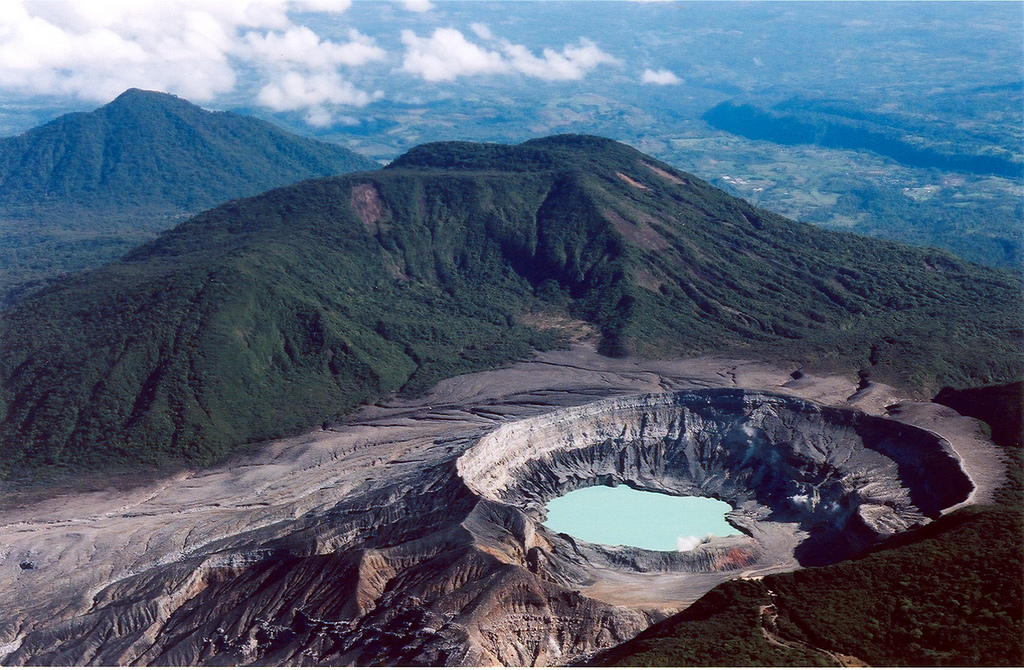
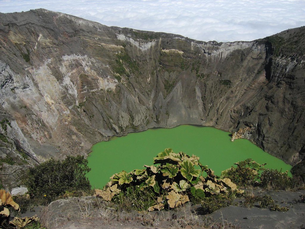
Poás Volcano
Elevation; 8,885 ft
Map Points: 10.199039, -84.230461
Poas is an eruptive and active volcano. It is, by contrast to Miravalles, more travelled. Travel here is markedly easier, with paved roads to the summit, and services at the top: restrooms, a cafe, and even a museum. Eruptions have occurred as recent February 25th, of 2014 when a plume of steam was recorded at the summit.
Visitors usually make day trips from San Jose. They go to observe the amazing views, and the wildlife. The area outside the cauldron, the larger of two lakes at the summit, is teaming with life, diverse, and protected. Life there is a little less verdant. The larger lake is very acidic, and lined with sulphur. The smell of sulfur gets so profound sometimes that rangers close the park.
This is the easiest peak in Costa Rica to summit: drive, bus, hike or even take a helicopter. Just kidding. We don’t know if you can take a helicopter. It’s about an hour and half from San Jose. It's recommended going during the dryer season, when cloud-cover is less likely to obscure your view.
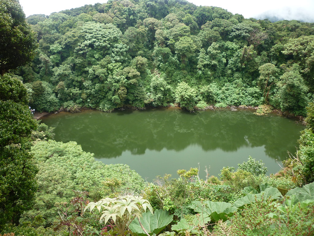
Barva Volcano
Elevation: 9,534 ft
Map Points: 10.135588, -84.100086
Barva is the volcano that doesn’t quite seem like a volcano. It’s very dormant, the last activity over 8000-years back. Compared to Poás, this crater feels very safe, but don’t expect to gaze up at it from the base of the hill. It's barely protruding at the summit.
The author of this article can speak from personal experience that it's possible to hike the road up, pay the ranger for access, and hike in, but there are cars on the road. That said, there are some amazing views en route. The air gets so clear you may think someone window cleaned your eyeballs, and the route is marked by farms, small towns, and sodas serving typical food. Bring Colones.
You get to the volcano by first finding Birri, just up from the peak's namesake of Barva. If you’re not so crazy to hike the road in, you can drive up to the edge of the park in less than twenty-minutes. From there the hike in is a little difficult, but only a slight grade, with very little climbing. Where the trail gets more vertical there’s steps. The lake itself is down inside the cauldron. You can hike around the edge, or just snap some pictures, and hike back out. There are no services at the cauldron.
Irazú Vlcano
Elevation: 11,260 ft
Map Points: 9.976899, -83.854188
“El Coloso,” or The Colossus, as locals call it, has a ridiculous five craters at it’s peak. Irazú’s checkered past includes some serious eruptions along the way.
Wikipedia reports this bad boy has over twenty-eruptions since we first recorded them in the 1723. The most recently famous eruption was this past century (1963-1965) when John F. Kennedy was visiting. In December of 1994 there was another, less fantastic eruption.
Similar to Poás getting to Irazú is pretty easy. There’s a road to the peak and a bus from San Jose that travels that route. If the weather is clear, which is unlikely, you can see both the west and east coasts.
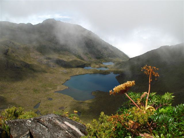
Cerro Chirripó
Elevation: 12,533 ft
Map Points: 9.485006, -83.490005
At 3,820 meters, the hight of this beast is less than half that of Everest; 8,840 meters. One can imagine the climb really puts Everest into perspective.
There's no road or bus to the top of Chirripó. You have to hike it if you want to get the view. If it’s not cloudy you can see both coasts from the summit, and you will hike over 12-miles (19.5-kilometers) from the trailhead to enjoy it. You will also a permit from he national park office. Good luck with all of that. Truly.
Well, we don’t know about you, but this list has made us dizzy. There’s probably a good reason we live on the beach. The biggest thing we were made to climb was a few waves. Have you ever seen the view at the top of a wave? Not bad. But if you are the sort who likes to hike, we hope you found this article fun, and interesting. You should send it to your friends who like to hike. It’s a good way to lure them to Costa Rica.
If there was ever a time to join us on Pinterest it's now.